About Uganda
Steven Dutch, Wells4Uganda, Inc., 1721 Badger Street, Green Bay, Wisconsin 54303-2621
Professor Emeritus, Natural and Applied Sciences, University of Wisconsin - Green Bay
Geography
Uganda has a total area of 241,038 square kilometers (93,065 square miles) of which 200,523 square kilometers (77,422 square miles) is land. 40,515 square kilometers (15,463 square miles) is water, mostly the northwestern part of Lake Victoria, but a few other large lakes as well. 18% of its area is water. A few comparisons with the U.S.:
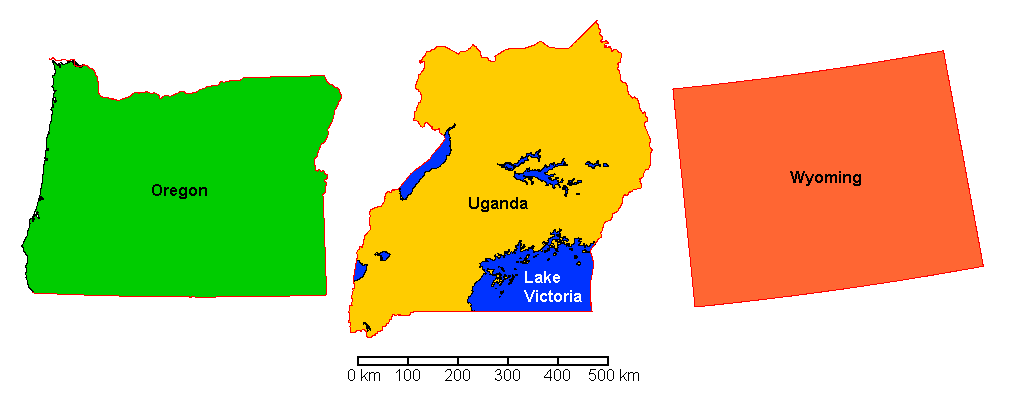
The total area is a bit smaller than Oregon (98,381 square miles) or Wyoming (97,813 square miles)
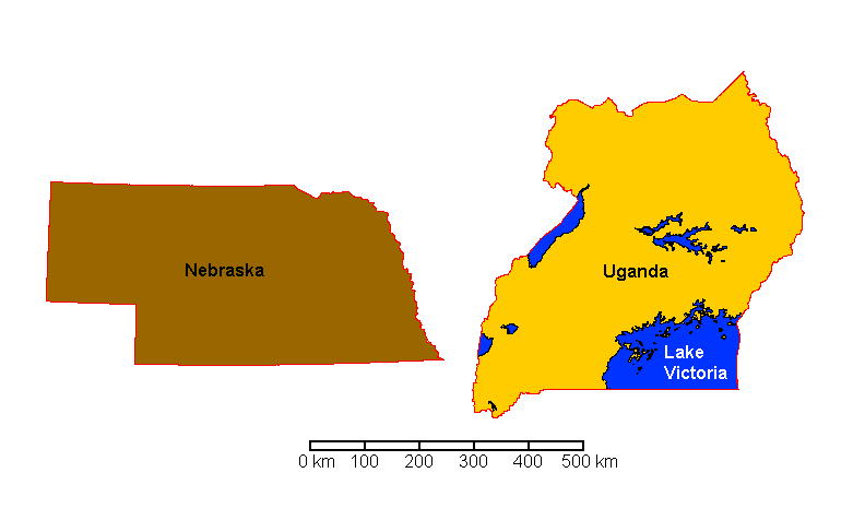
The land area of Uganda is about equal to Nebraska (77,347 square miles)
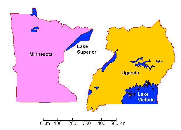
Since so much of Uganda's area is water, perhaps the best comparison is with Minnesota which has a total area of 86,935 square miles and a land area of 79,626 square miles.
With all that water, why are we raising money for wells?
- Surface water is usually contaminated with sediment, disease organisms and animal waste.
- Uganda is much too poor to run pipelines to every remote village, plus build water purification plants.
The population of Uganda is 42.8 million. Useful comparisons with the U.S. include:
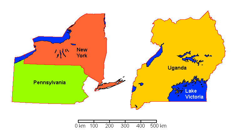
New York and Pennsylvania combined. Total area: 91,958 square miles, total population 32.3 million
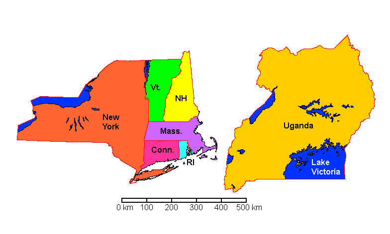
New York plus the New England States except Maine: Total area 79,061 square miles, comparable to the land area of Uganda. Total population: 33 million
Non-U.S. Comparisons
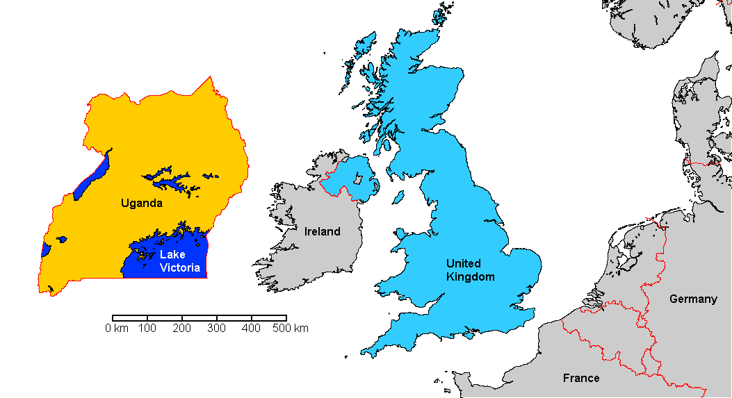
Uganda is very slightly smaller than the United Kingdom. The United Kingdom looks larger because of its shape.
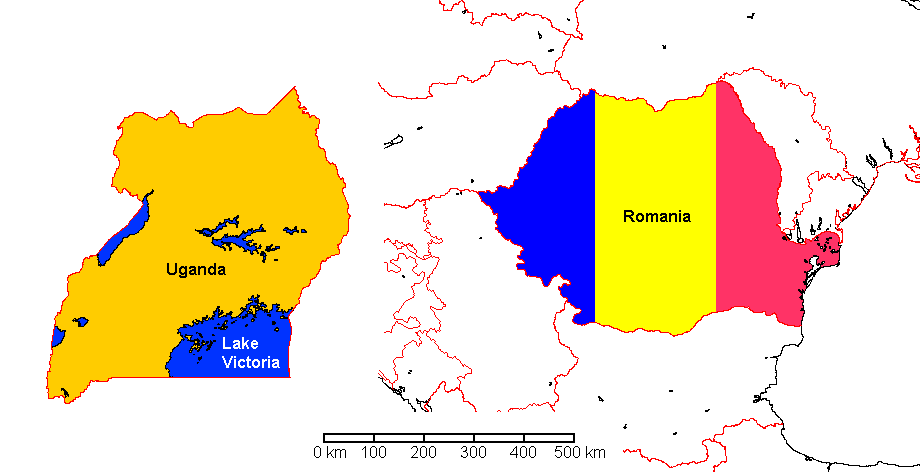
Uganda is just a bit larger than Romania.
Topography
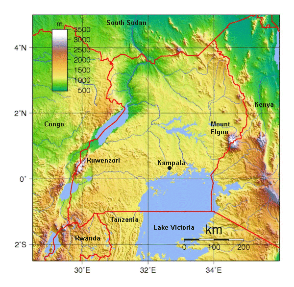
Much of Uganda is a moderately elevated plateau around a kilometer in elevation. To the west is the East African Rift Valley. Lake Victoria is the second largest fresh water lake in the world, after Lake Superior. It drains northward through the Victoria Nile. On the western boundary with the Congo are the Ruwenzori Mountains, up to 5,109 m (16,762 ft) in elevation, with permanent glaciers at their summits, even though they are barely north of the equator. On the eastern border with Kenya is an extinct volcano, Mount Elgon, 4,321 metres (14,177 ft) in elevation, high enough to get occasional light snow. Unlikely as it seems, it does snow in Uganda.
Culture
Uganda has about 50 tribal languages. The two official languages are English and Swahili, neither of which, surprisingly, is indigenous to Uganda. English is a colonial language and Swahili is a trade language widely spoken in East Africa. Both are official because they are widely spoken, whereas the tribal languages are local.
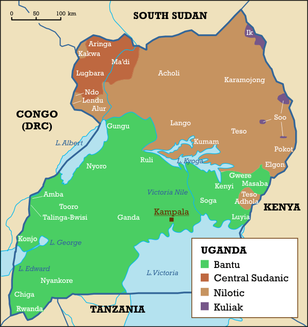
The map below shows the tribal groups of Uganda. Unfortunately the legend is too small to read but the map shows the tribal complexity of Uganda.
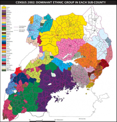
Below are the traditional tribal kingdoms of Uganda. You can see from the map above they correspond closely to the tribal groups.
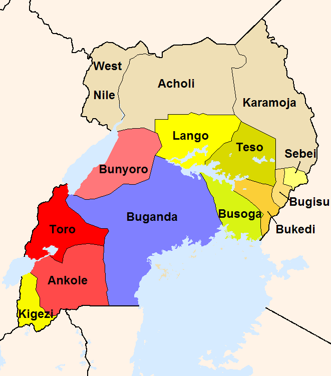
The country is Uganda. The kingdom west and south of Kampala is Buganda. The language is Luganda (Ganda on this map). All clear? There will be a quiz later.
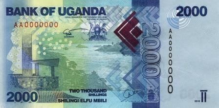
Uganda banknote. Note the denomination at bottom center, in English and Swahili.
Return to Wells4Uganda Home Page
Created 15 September 2020, Last Update 30 October 2020